
Note that the trails on the west side of Hwy 59 around the Lester Beach area (west of the old rail line and in the gravel pits) are mostly on private property. Many are posted as no trespassing so please respect the land owners rights. The onus is on the ATV/ORV rider to determine if the trail is on private land or not rather than the land owner to inform you.
The Belair Forest region is characterized by a mixture of coniferous and deciduous trees including vast stands of jack pine, red pine, spruce, balsam fir, birch, popular and ash forest cover. The trails in the Belair Forest were mostly created through old logging operations and typically surrounded large forest harvesting cutting sites. Other trails are forest resource roads and used for gravel quarry operations and also serve as fire guards.
Much of the forest area has been logged over the last 75 or more years and have subsequently been reforested by large areas of red pine which are doing very well in the primarily sandy soils. In fact, much of the Belair Forest is uplands and on an ancient beach ridge and accounts for the many sand and gravel deposits and primarily sand based trails.
These sandy trails are well suited for ATV riding because they don’t get muddy and are very forgiving to ATV travel due to the sand base simply falling back upon itself after an ATV travels the trail. While the majority of trails are sand based and dry out almost immediately after a rain, some of the lowland areas do contain a softer trail base and care should be taken to not rut these areas up during wet weather.
Most trails are easily accessible from all the major subdivisions in the area and our club asks that you to please respect others in your community area and do not drive with excessive speed or make noise when navigating out of the built up areas to access the trails. We all share a unique riding area and we do not want to jeopardize our riding privileges through carelessness.
The over 500 kilometers of forest trails provide a host of beautiful scenery areas to explore. Many of these trails date back to the early days of settlement in the area and provided a means of travel and access to timber and aggregate and today, lets us hanker back to the old days. Some are major trails like the famous North Star Trail running from Stead north west to where it intersects Hwy. #59 and also the Ridge Trail which starts from where the North Star Trail hits Hwy. #59 and continues north to where it intersects Hwy. #11 close to Traverse Bay Corner. There are beautiful picnic sites, bird watching, berry and mushroom picking and scenic vistas to be found. Another unique trail is the old rail line from Victoria Beach all the way to Grand Marais and passes through the community of Belair. This rail line was famous for its steam train transport of thousands of weekend travelers from Winnipeg to the glory days of the Grand Beach and Victoria Beach old dance halls, board walks and resident summer cottages in the region.
The Belair ATV Club has acquired authorization and entered into an agreement with the Province of Manitoba to operate a network of designated ATV trails spanning from Stead to Albert Beach and many loops branching off of the primary main North/South stem trails. In addition, the club also manages our 29 km Whistle Pig multi use ATV trail on the old rail bed from Pine Falls to past Gull Lake and we are exploring opportunities to extend that for the balance of the rail bed all the way to East Selkirk. Please see the attached downloadable maps below. We will soon be posting detailed downloadable maps of all the hundreds of kilometers or other trails in the region along with Google Earth .KMZ files and Garmin .GPX files to help you with navigation in this vast network. The club now has acquired all the new signage and will complete installation in the spring of 2019. See maps below:
To download and save any of these map files click on the thumbnail picture and it will enlarge. Next. right click on the picture with your curser and select “Save Picture As” and save it in any directory or select “Print Picture”.
[ngg_images source=”galleries” container_ids=”9″ display_type=”photocrati-nextgen_basic_thumbnails” override_thumbnail_settings=”0″ thumbnail_width=”240″ thumbnail_height=”160″ thumbnail_crop=”1″ images_per_page=”40″ number_of_columns=”5″ ajax_pagination=”0″ show_all_in_lightbox=”0″ use_imagebrowser_effect=”0″ show_slideshow_link=”1″ slideshow_link_text=”[Show slideshow]” order_by=”sortorder” order_direction=”ASC” returns=”included” maximum_entity_count=”500″]
The North Star Trail Riding Tour
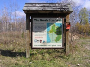
One of the most famous trails in the Belair Forest in the North Star Trail which is a 40 km interpretative driving trail starting at Stead, Manitoba at the intersection of Hwy. #304 and heads northward until it reaches Hwy. #59. This North Star trail is a favorite of many users and can be traversed by ATV/UTV’s or jeeps or by truck. Many of these old trails have their origins dating back 100 years and were the primary access routes into the region.